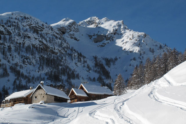
 Serre Chevalier is located in the Ecrins National Park in the Hautes-Alpes region of France, close to border with Italy. The ski area extends westwards from the town of Briançon towards the Col du Lauteret, through the villages of Saint-Chaffrey / Chantemerle, Villeneuve / La Salle les Alpes and Monêtier les Bains. The resort's alpine ski slopes are suitable for all types of skier from beginners to experts. Skiers can enjoy a variety of slopes, amidst larch forests in the valleys or can attempt the some of the renowned off-piste runs.
Serre Chevalier also offers other cultural, spa and recreational activities.
 Downhill skiing
- Maximum altitude: 2830 m
- Minimum altitude: 1200 m
- Number of ski lifts: 58 (cable cars: 1, gondola lifts: 5, chairlifts: 20, drag lifts: 28, carpet lifts: 4)
- Number of ski runs: 17 (black: 3, red: 8, blue: 6, green: 0)
- Total distance: 250 km
- Dedicated activity areas: 2 (boarder cross: 1, snow park: 1)
- Piste map
 Cross-country skiing
- Number of runs: 6 (black: 1, red: 3, blue: 1, green: 1)
- Total distance: 35 km
- Piste map
 Snow conditions
Last updated: Sunday, 20 April 2025 at 15:02
Downhill ski area
- Snow conditions:

- Snow depth on lower slopes: 35cm
- Snow depth on upper slopes: 159cm
- Avalanche risk:

- Return by ski:

- Black runs open: 0 / 3
- Red runs open: 3 / 8
- Blue runs open: 5 / 6
- Green runs open: 0 /
- Runs open : 8 / 17
- Lifts open: 4 / 58
 Weather
Last updated: Sunday, 20 April 2025 at 15:02
- Temperature at summit: -4°C
- Temperature at base: 6°C
Today Sunday | Tomorrow Monday |
 Distance by car
- Turin to Serre Chevalier: 118 kilometres (73 miles). Estimated time: 1 hour 58 minutes
- Grenoble to Serre Chevalier: 125 kilometres (78 miles). Estimated time: 2 hours 25 minutes
- Chambéry to Serre Chevalier: 183 kilometres (114 miles). Estimated time: 2 hours 57 minutes
